Narayan Sarovar Fm
Type Locality and Naming
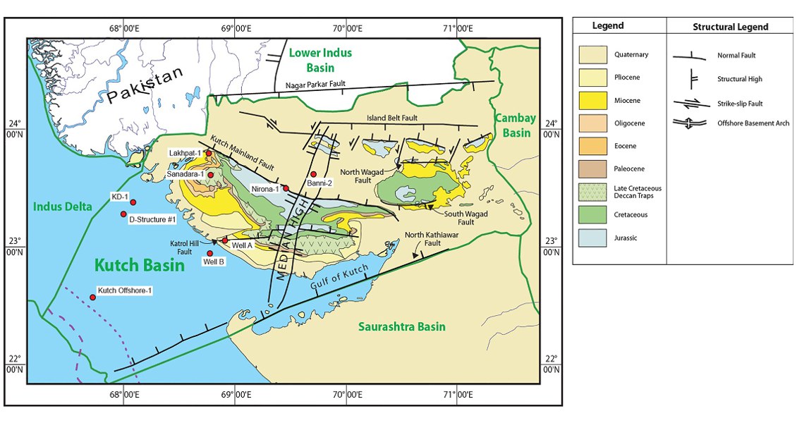
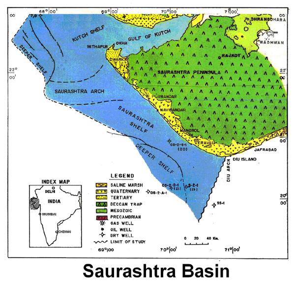
SUBSURFACE. Its type section is in Well KD-1, interval of 695-742m. [Original Publication: Zutshi, P.L., Mittal, S.K and Shah, L. (1993) Lithostratigraphy of Indian Petroliferous Basins, Document IV, Kutch Saurashtra Basin, KDMIPE, ONGC Publication, pp 1-50.]. Reference well: Well OS-2-G-1, interval of 1360 to 1555 m.
Synonyms: Called Narayan Sarovar Fm (one word) in Kutch Basin subsurface
[Fig. Geological and structural map of Kutch, also showing the onshore and offshore wells drilled for oil exploration. (Map by Rasoul Sorkhabi in GeoExpro Dec2014, based on various sources including S.K. Biswas, Current Science, 25May2005)]
Lithology and Thickness
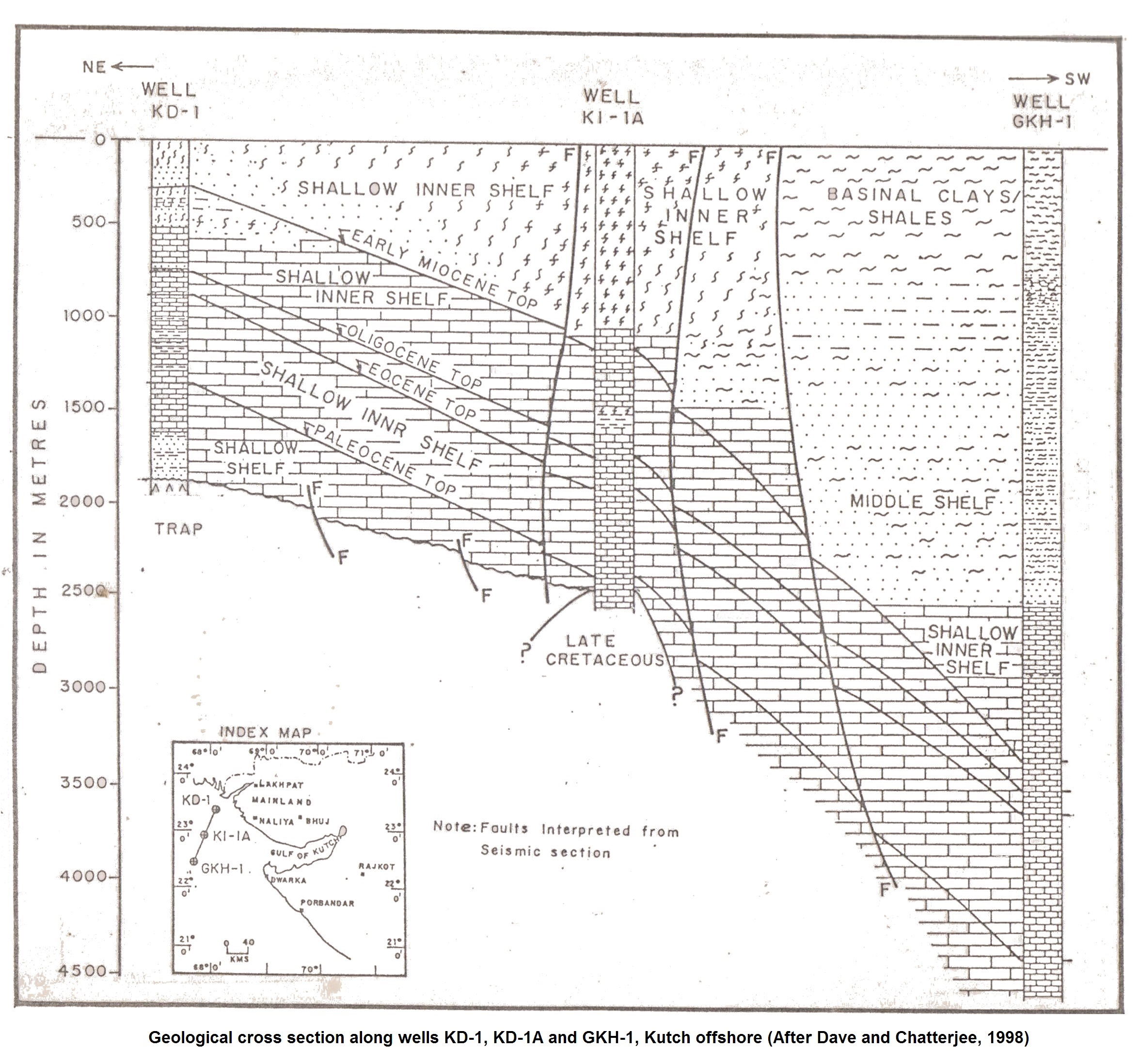
Limestone. Consists of dirty white, grayish, brownish, hard, massive, compact and fossiliferous limestone (grainstone/packstone with abundant carbonaceous matter). With greenish grey to grey, feebly calcareous and fossiliferous claystone and colorless fine grained, sub-rounded sandstone. In the northern part of Saurashtra Basin, there is reduction in argillaceous matter and increase in carbonaceous matter within this formation. It is 205 m thick in Well OS-2-G-1, toward Diu Arch (Saurashtra Basin) its thickness increases up to 378 m in Well S-2-1. 47 m in well KD-1. There is general increase in thickness towards west and NW.
[Figure 1: Geological cross section along wells KD-1, KD-1A and KGH-1, Kutch Offshore (after Dave and Chatterjee, 1998)]
Relationships and Distribution
Lower contact
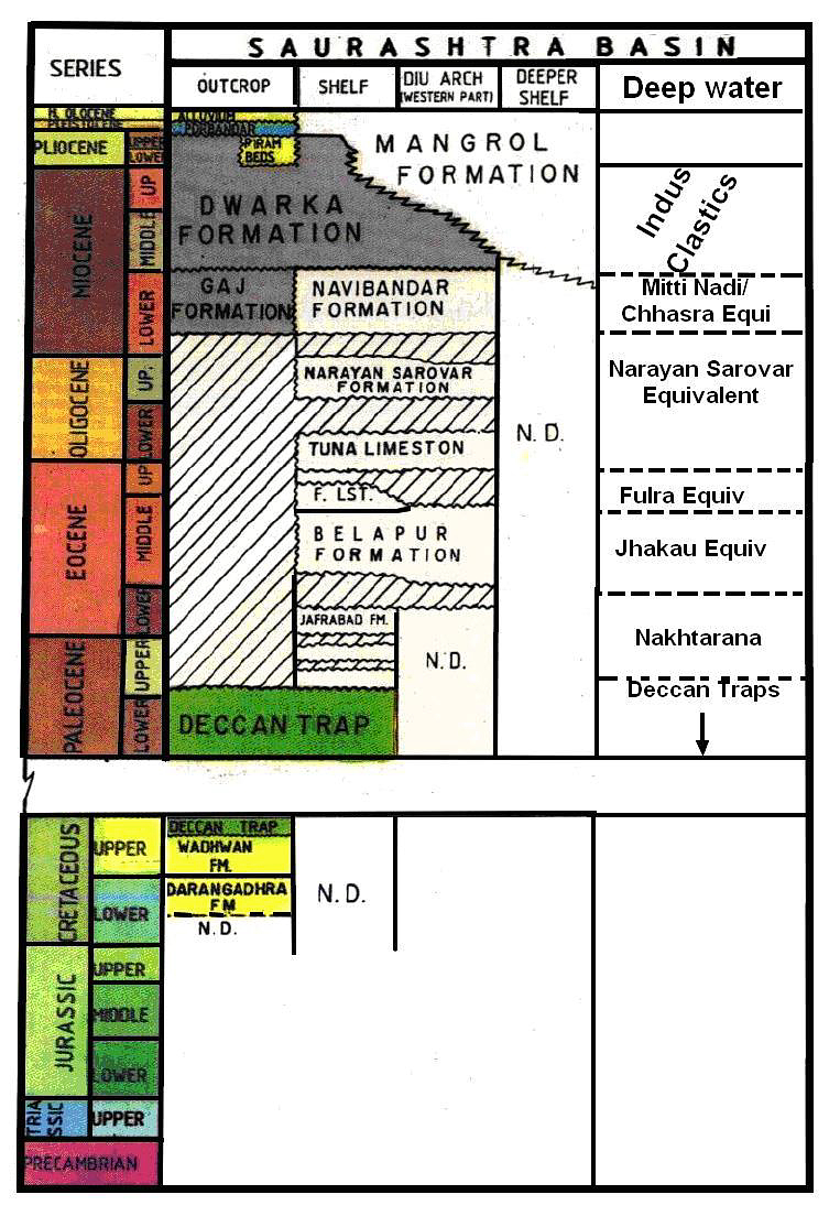
Unconformable with the Tuna Fm limestone. It can be marked on the log by increase in gamma and reduction in resistivity.
Upper contact
Unconformable with the Godhara Fm in Kutch Basin, and unconformable with the Nabibandar Fm in the Saurashtra Basin. It can be marked on the log by a sharp break on gamma and resistivity logs.
Regional extent
Kutch and Saurshtra basins subsurface
GeoJSON
Fossils
M.(M.) complanata, Gryzbouskew tandoni, Spinoclypeus ranjanae, G. gortani, Lepidocyclina, Spiroclypeus
Age
Depositional setting
Inner shelf environment suggested by faunal and lithological data. Over the Kutch shelf and GKH area was inner shelf, whereas it was outer shelf in the western part of Kutch offshore.
Additional Information


